Forestmap.ai Research
Foundational AI for understanding forests
“The future of forest remote sensing lies in grounding powerful AI tools in real ecological data.”
Forest science spans scales from individual trees to the global biosphere, but our analytical tools rarely do. Models built for fine-scale ecological inference often fail to scale, while global approaches risk losing contact with ecological reality.
Forestmap.ai Research develops geospatial AI methods that bridge these scales. Our research combines individual tree detection, spatiotemporal forecasting, and large-scale foundation models to study forest composition, structure, and change. Crucially, we ground these techniques in field-based ecological data, using measurements of real forests to interrogate, validate, and interpret AI models. Our aim is not simply scalable prediction, but ecological understanding that remains meaningful from the level of individual organisms to pan-tropical forest systems.

Beyond Monitoring
We are advancing the frontier of geospatial intelligence by moving beyond simple monitoring to predictive understanding. Our research agenda is built on three core pillars designed to decode the complexity of the world’s forests.
01
Individual Tree Detection
We develop computer vision pipelines capable of delineating and identifying species of single tree crowns in dense canopies, enabling precise biomass estimation and automated carbon and biodiversity inventory at scale.

02
Geospatial Forecasting
Shifting from reactive monitoring to proactive forecasting. By analyzing historical temporal signals, we develop models predict future ecosystem changes allowing stakeholders to anticipate shifts in forest cover before they occur.

03
Geospatial Foundation Models
We develop methods for applying emerging geospatial foundation models to forest ecosystems at scale. Our work focuses on using their embeddings to map forest composition, traits, and change across biomes, and to reveal new ecological signals.

Research Highlights
-
![]()
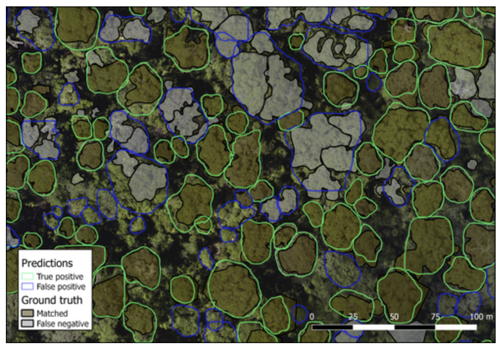
Detectree2 - Crown Delineation with Mask R-CNN
Python package for automatic tree crown delineation in aerial RGB and multispectral imagery based on Mask R-CNN.
-
![]()
Deforestation Forecasting with Deep CNN
Forecasting deforestation in complex Amazonian tropical forests by using deep neural networks to learn the spatial–temporal dynamics of forest loss.
-
![]()
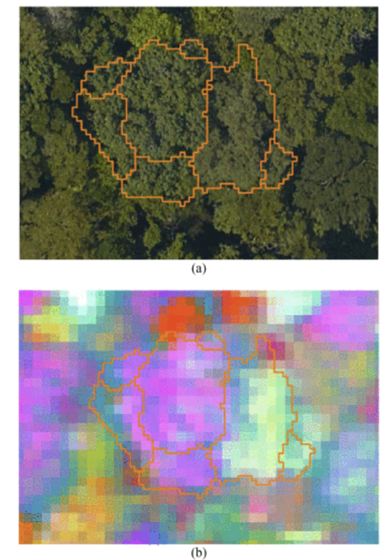
Harnessing Temporal and Spectral Dimensions for Tree Species Mapping
Combining multi-temporal deep learning–based crown segmentation with hyperspectral imaging enables accurate, scalable mapping of species-level canopy composition in complex tropical forests.
-
![]()
Multisensor Fusion for Tree Segmentation
Fusing airborne laser scanning with multispectral and hyperspectral data through deep learning significantly improves individual tree crown segmentation in dense tropical forests and enables reliable estimation of tree mortality from repeated remote sensing observations.