Ecologists and engineers who build what they publish.
We’re a team of scientists passionate about bridging the latest research with real-world applications in forest conservation and management.

Dr James Ball
James’ research integrates remote sensing, tropical ecology, and artificial intelligence to map, monitor and forecast biodiversity in some of the world’s most complex forest landscapes.
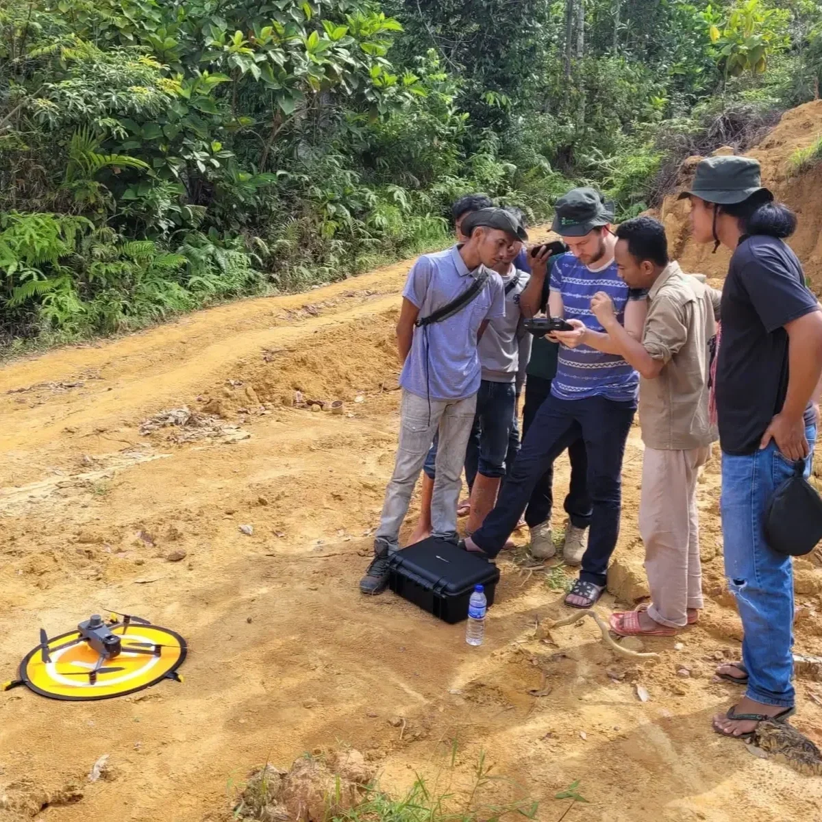
Alongside deep technical expertise in machine learning and geospatial analysis, he brings extensive on-the-ground experience from field campaigns across Southeast Asia, South America, and Africa. His work bridges cutting-edge science with real-world conservation challenges, helping organisations develop AI-driven solutions to protect forests and respond to the climate crisis.
Founder & CEO

Kingston Kingsley
Kingston pairs quantitative modelling with a rare ability to make complex science clear. A physicist by training - with a First-Class degree in Physics and Philosophy and an MPhil at the University of Cambridge, where he modelled James Webb Space Telescope data using Bayesian inference and statistical methods in Python.
Kingston moved into data science via climate and sustainability work. After years as a scientific editor and writer, he helps forestmap.ai turn technical forest-AI work into insights that clients, partners, and wider audiences can act on, while supporting our data analysis and visualisation.
Data Scientist & Science Communications
Christopher Kotthoff
Christopher is a computer scientist specialising in applying modern computer vision to aerial forest imagery, with a focus on automated tree mapping and ecological monitoring.
He completed his MSc in Computer Science at ETH Zürich, carrying out his thesis at Cambridge, where he developed deep-learning methods for tree detection and contributed to the Detectree2 open-source project. Alongside his academic work, he’s led software efforts in high-performance engineering teams and AI start-ups. At Forestmap.ai, he supports our advanced modelling pipeline and brings cutting-edge computer vision expertise to large-scale forest analysis.
Senior Computer Vision Consultant
Our Mission
Navigating the Future of Forest Monitoring
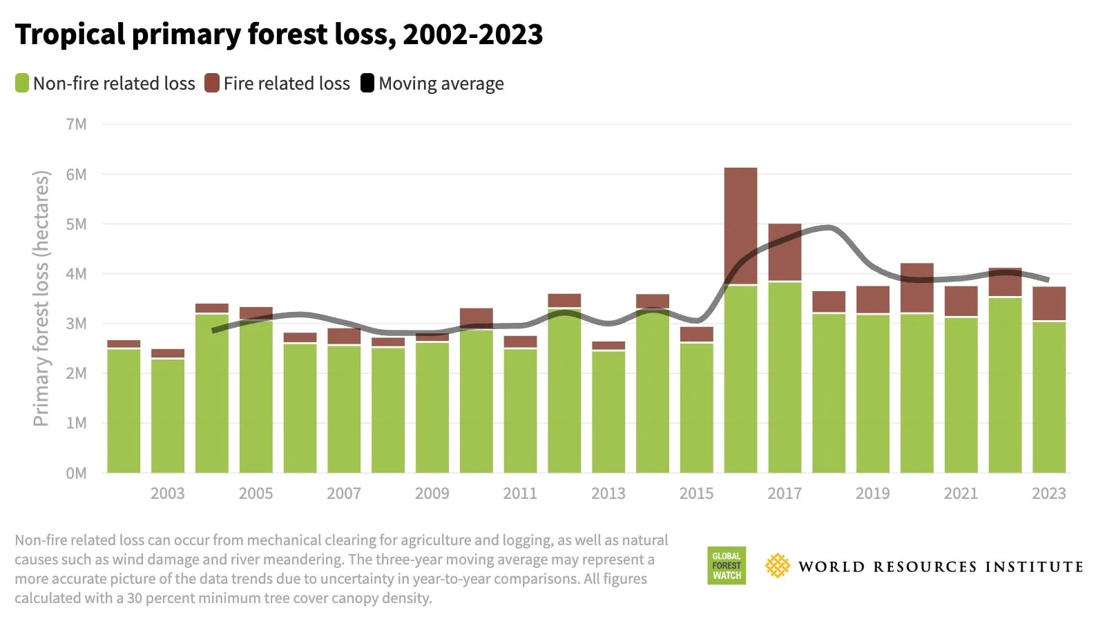
Tropical forests are the most biodiverse and dynamic ecosystems on Earth. They've evolved over millions of years, and today they support half of all terrestrial species and store vast amounts of carbon, helping regulate our climate. But these crucial ecosystems face unprecedented threats from deforestation, climate change, and other human activity. Understanding and protecting them has never been more urgent.

At forestmap.ai, we're harnessing the power of artificial intelligence (AI) and cutting-edge remote sensing technology to revolutionize how we monitor and map tropical forests. Our mission is to provide accurate, large-scale insights into forest health, biodiversity, and carbon dynamics, enabling organizations to make informed decisions about conservation and sustainable management.
Let’s Discuss Your Forest.
Reach out to find out more about how forestmap.ai can help your organization.
info@forestmap.ai
+44 (0)7986 882 740
By submitting this form, you acknowledge our Privacy Policy.
