
Case Studies
From continental REDD+ jurisdictions, to a single island or city streets, forestmap.ai turns complex remote sensing data into ecological intelligence that drives real decisions.
Here are three engagements that show how we deliver systems clients can run, review, and act on — at landscape, island, and city scale.
Case Study
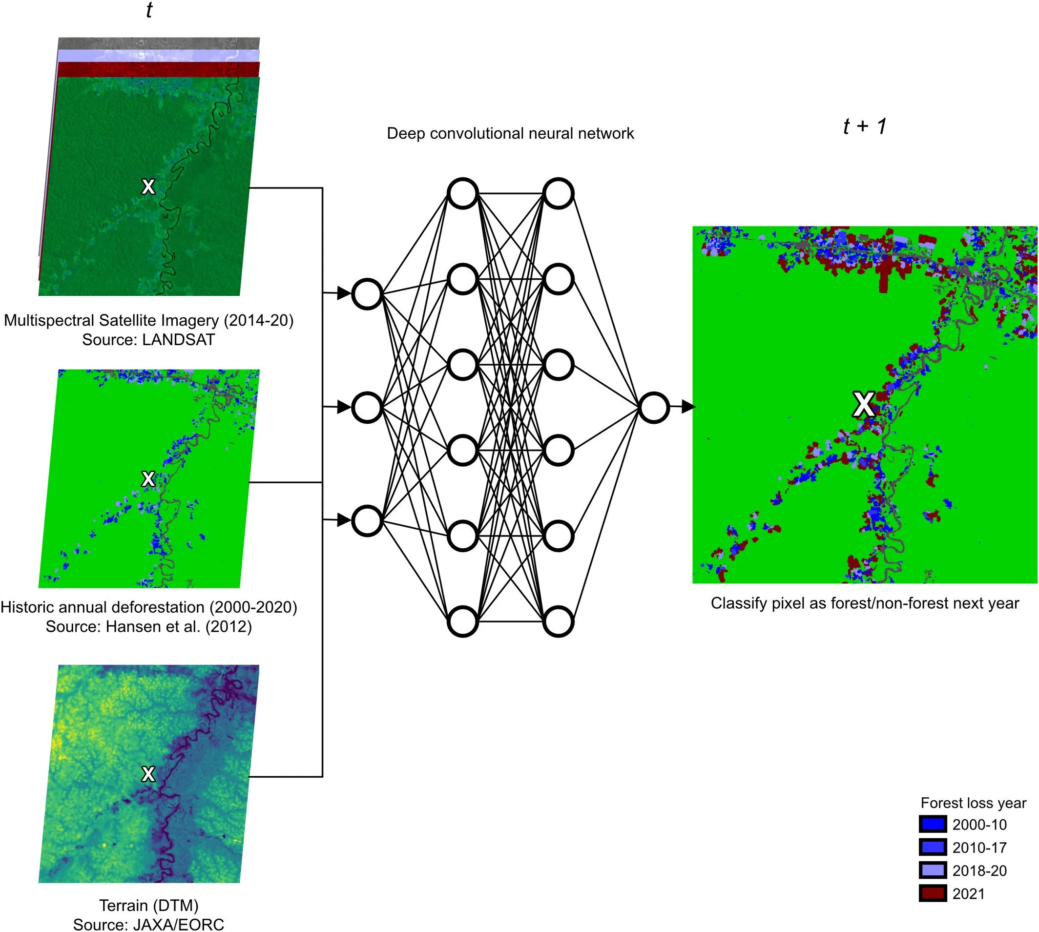
Biomass forecasting for next-generation carbon credits
We built and deployed an AI-driven biomass forecasting system that produces pixel level (~30m) risk maps for Wildlife Works, one of the world's leading REDD+ project developers.
The forecasting system now underpins EquitableEarth's M002 Terrestrial Forest Conservation Methodology worldwide, which entered public consultation in 2025 and is being adopted by REDD+ projects.
Wildlife Works / EquitableEarth
BaKIM / Smart City Bamberg
Case Study
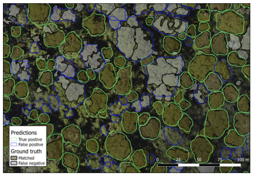
Taking a tree-monitoring AI from research to operational rollout
We were brought in as the AI and computer-vision experts to move a research-grade municipal tree monitoring system into production — optimising the detection pipeline, extending its capabilities, and integrating it into a deployable web application that city staff can run operationally.
The system entered practical use in mid-2026 and is now expanding to additional German municipalities.
Case Study
Mapping an Island’s Tree to Protect Its Future
Faya Foundation needed a baseline understanding of what grows across Principe Island's forests: a UNESCO Biosphere Reserve with over 110 tree species and several previously unrecorded to science.
We combined high-resolution aerial imagery with field survey data to produce a spatially explicit tree and species map, now used to track forest health and guide conservation priorities under the Foundation's "Natural Dividend" model.
Faya Foundation
